 LA COUNTY FIRE KNOW YOUR ZONE! Emergency Evacuation Zones within Fire Hazard Severity Zones established
Download Media Advisory – Know Your Zone
Emergency Evacuation Zones within Fire Hazard Severity Zones established in Santa Clarita, La Cañada Flintridge, and surrounding communities
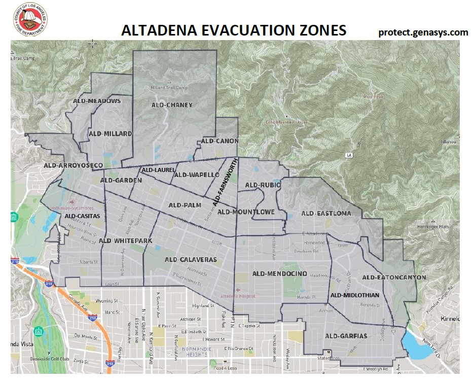
Los Angeles County (County) public safety agencies and the County’s Fifth District Supervisor Kathryn Barger are excited to announce the “Know Your Zone” campaign, a collaborative effort that aims to prepare residents and businesses for emergencies or evacuations. Included in this roll-out are the Cities of Santa Clarita and La Cañada Flintridge; the communities of Agua Dulce, Altadena, Castaic, Gorman, Kagel Canyon, La Crescenta/Montrose, and Stevenson Ranch; and the unincorporated areas of Santa Clarita, Chatsworth, and Pasadena.
“I’m thrilled that our County’s public safety agencies are rolling out this emergency evacuation preparedness tool,” said Supervisor Barger. “The devastation we’ve witnessed in Maui is our latest reminder that wildfires move quickly and can have disastrous consequences.”
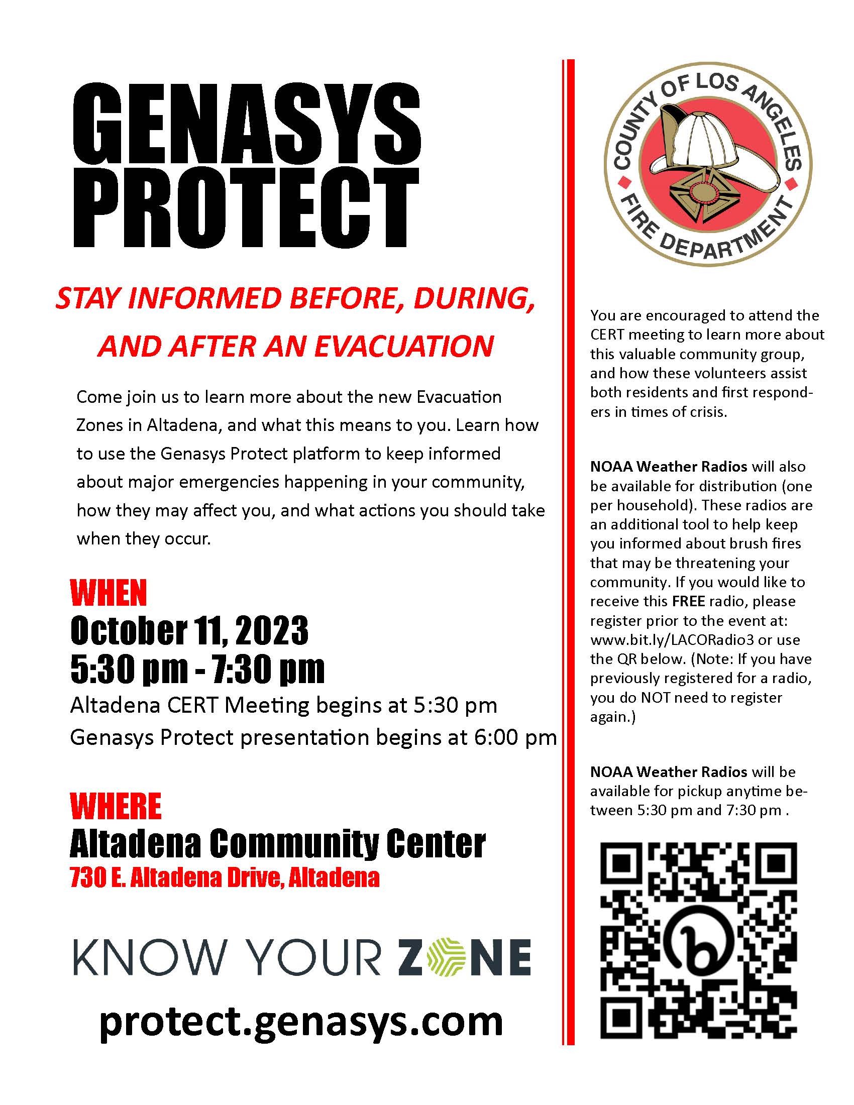
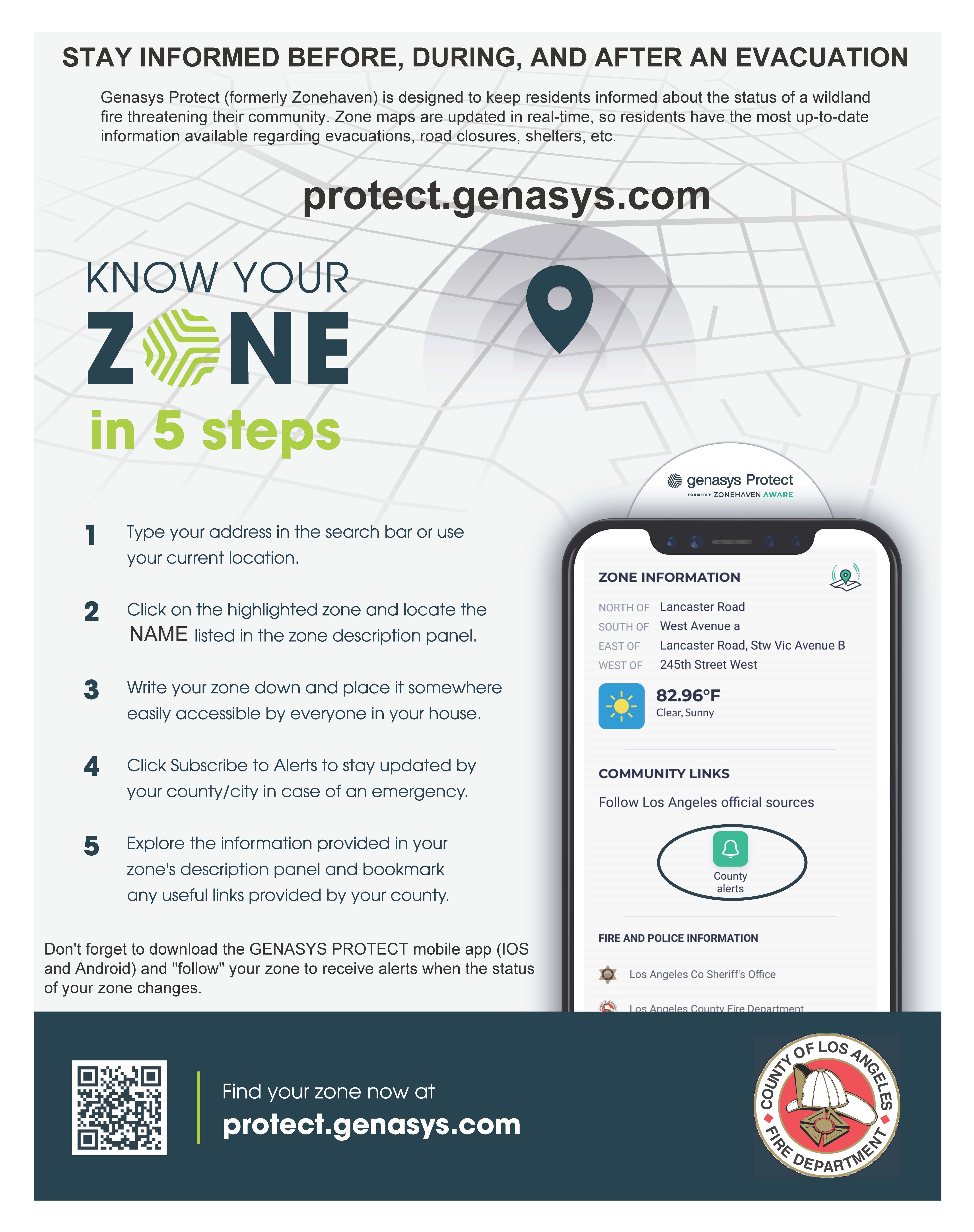
Using the Genasys Protect platform (formerly known as Zonehaven), first responders and residents will refer to the same set of Zone maps used for planning and conducting evacuations. Residents can now see their “Zone” and have access to information about emergency services in their zone, see real-time zone status updates, shelter options, and more. During a large-scale incident that requires evacuations, the Zone map will be updated in real time, so residents should check it regularly for status information.
“Being able to evacuate residents efficiently is a critical task that our public safety officials must perform and the public needs to be a partner in those efforts by knowing their zones,” added Barger.
To find their zone, residents enter an address into the interactive map on Genasys Protect at protect.genasys.com using the search bar provided. This will open a pop-up window, which includes the zone name and information about the zone and its emergency services. Residents should look up and record the names of all the zones they frequent – such as home, work, school, or homes of loved ones – and keep them in an easily visible place (on the refrigerator or next to the door). Zones will be used in emergency alert notifications, so knowing the name of your zone is an important part of your emergency plan.
Genasys Protect is a mapping tool that is used in combination with public alert and warning systems such as ALERT LA County and local City emergency alerting systems. Residents should sign up for systems in their area to receive evacuation orders when issued by public officials. When evacuation warnings or orders are issued for zoned areas, notices will include Zone designations in addition to major streets and intersections.
Residents can also download the Genasys Protect mobile app (IOS and Android). On the app, residents can “follow” their zone so that they are alerted when the status of their zone changes. At this time, only one zone can be followed. Once an alert is received, residents will need to open the app or go to the website to view the status change and associated messaging.
Other areas of the County using the Genasys Protect platform include Agoura Hills, Calabasas, Hidden Hills, Malibu, Westlake Village, Topanga, Palos Verdes Estates, Rancho Palos Verdes, Rolling Hills, Rolling Hills Estates, and some parts of the Antelope Valley.
Learn more about public alert and warning systems in LA County here:
https://ready.lacounty.gov/emergency-notifications/
# # ##